Marine conservation has always been important around St. Abbs and Eyemouth when a voluntary ban on the removal of shellfish was first imposed by divers back in the early 1970s with many diving clubs supporting this move.
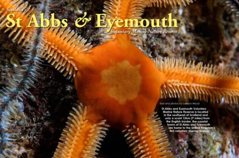
The first real change came in 1978 when Lawson Wood declared a small area to the north of Eyemouth the first voluntary marine reserve in Scotland. Barefoots, as it was then known, is still a major part of the St. Abbs and Eyemouth Voluntary Marine Nature Reserve, which was founded in 1984 and officially opened by Professor David Bellamy in 1986.
Contributed by
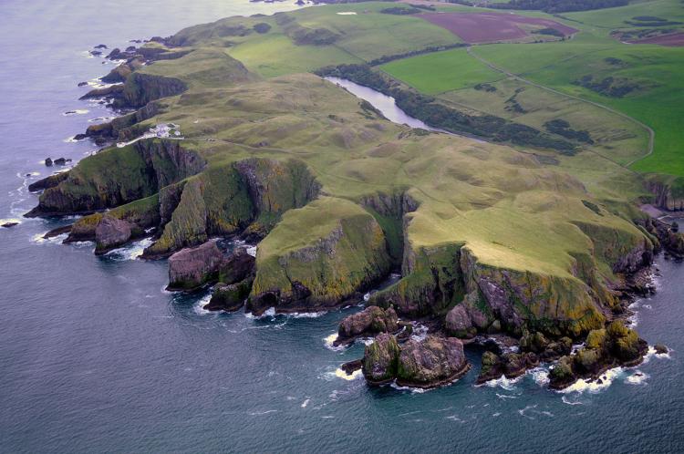
Located just 15km (9 miles) north of the English border, the reserve now extends from the Hurkar Rocks at Eyemouth to St. Abbs Head and includes 7km (4.5 miles) of coastline and out to the 50 metre (165ft) depth contour. Lawson Wood was awarded the prestigious conservation award by the Marine Conservation Society in 1982 for his efforts. The author gives us a glimpse into the underwater world, flora and fauna, which divers will find in the nature reserve.
Since 1986, the marine reserve has been able to employ a warden who has liaised with divers, school groups, conservation organisations and local council authorities. Publicity materials have been published, the rock pool rambles are particularly well attended, and a new code of conduct has been produced for the benefit of all visitors to the area.
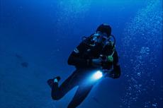
The Marine Reserve has 17 member partners on the committee including local council authorities, diving clubs, fishermen and conservation groups. Whilst this feature details the shore diving and near shore boat dives, many divers from all over the world are now visiting this region of the south east of Scotland for some absolutely amazing Technical diving on many (virtually undived) shipwrecks from both World Wars including two U-boats. In depths ranging around 45-60m (150-200ft) these are some of the best military shipwrecks in British waters.
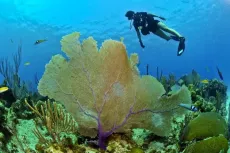
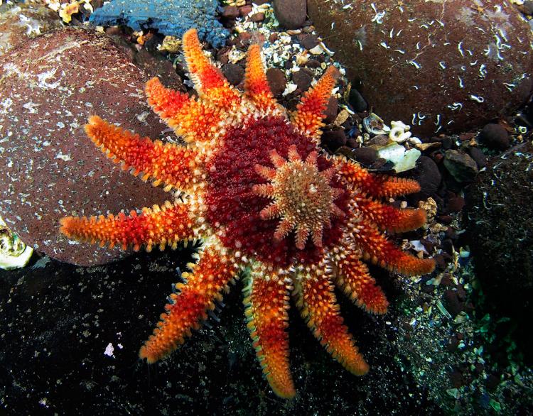
The rugged shoreline is home to some of the greatest diversity of marine life to be found around the entire British coast. Tidal currents from both the warm Gulf Stream and the much colder Arctic Tidal Stream both terminate along this stretch of coastline along the east coast of Scotland and have created an area of clear, clean water quite unrivalled in U.K. waters, where cold water species are found living alongside more exotic warm water species.
There is an almost total lack of ‘diver pollution’ except at one or two of the most popular sites, and then again, only during peak holiday time. This is due to the infrastructure available such as good road and rail links, accommodation of various types and standards, equipment sales and hire, boat hire, launching facilities, compressors, wrecks, good photography, etc. The dives within the confines of the marine reserve range from those easy, gently sloping shore dives to challenging drift dives in difficult tidal conditions.
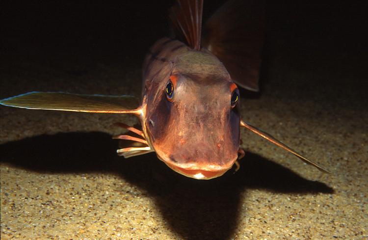
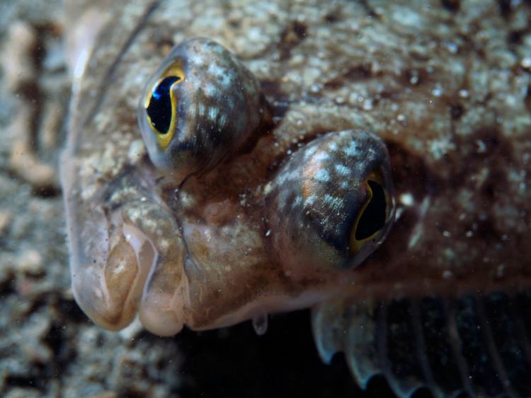
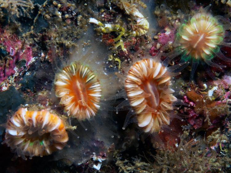
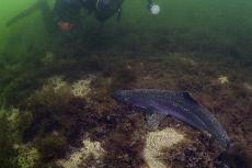
The sea bed is generally covered with large boulders falling away to gravel and sand at about the 20m zone (66ft). The exposed cliff faces are renowned for the great diversity of marine life and are festooned with ‘dead men’s’ fingers’ soft corals, brilliantly coloured anemones, hydroids, tunicates, fish and crustaceans. It is on these cliffs that Ballan wrasse eat out of your hand, and where wolf fish try to eat the rest of your hand!
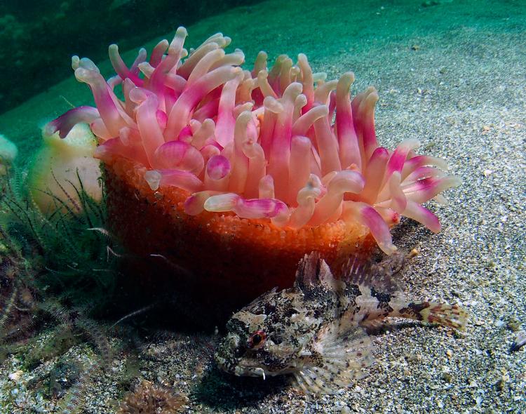
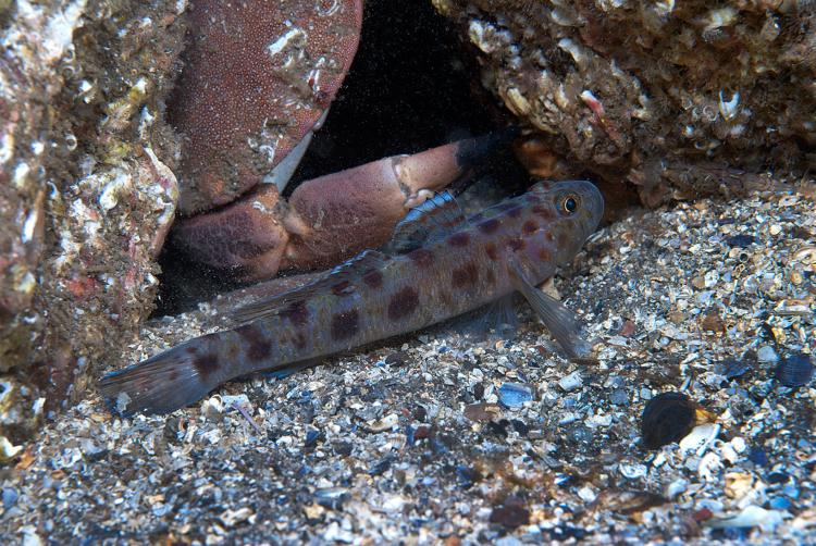
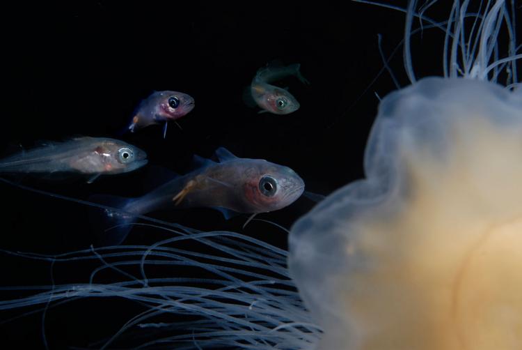
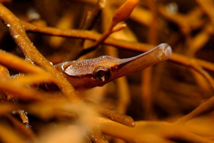
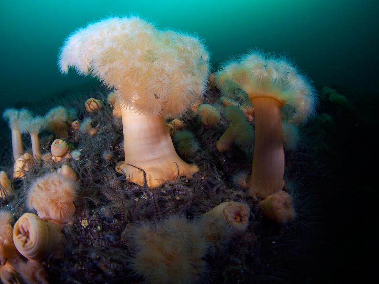
The predominant feature is the kelp forest, which fringes much of the coast, grazed by sea urchins and home to spider crabs, nudibranchs and two-spot blennies. Further offshore are brittle-star beds with giant dahlia and plumose anemones, the rare arctic Bolocera anemone, burrowing anemones and huge angler fish. Octopus and squid are common on night dives and the rare Yarrel’s blenny isn’t rare here amongst the gulleys, canyons and caves that cut through the headlands.
Curiously, species such as the Devonshire cup coral (Caryophillia smithii), Painted top shell (Calliostoma zizyphinum) and the long-clawed squat lobster (Munida rugosa) are more commonly found on the western coast of the British Isles, along with the burrowing anemone (Cerianthus lloydii) and Yarrel’s Blenny (Chirolophis ascannii) they make for very interesting finds in the North Sea. Many divers are also having superb in-water experiences with Grey seals which can be found north of St. Abbs Head and south of Eyemouth on the offshore reefs of Burnmouth. The St. Abbs and Eyemouth Voluntary Marine Nature Reserve is now part of the North Northumberland and Berwickshire Coast Special Area of Conservation and is part of the largest marine conservation zones in Europe.
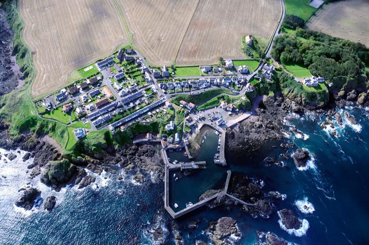
Eyemouth shore dives
The shore diving at Eyemouth is concentrated around the headland adjacent to Eyemouth Holiday Park. There are a handful of exceptional dives off the caravan park and although some of the access is a bit difficult at low tide, the diving is exceptional with cliff walls covered in soft corals and anemones.
Little Leeds Bay is reached by following the footpath from the caravan park and keeping to the right along the edge of the cliff. This is an ideal sheltered bay for trainees and the snorkelling is excellent with a profusion of life amongst the kelp covered boulders.
Divers Hole is the large cleft towards the end of Hairy Ness Point. The depth ranges from 7m (24ft) to 18 metres (60ft) and is best reached by swimming through the break in the headland. The cliff wall rises vertically on both sides and the amount of marine life to be found here is astonishing. At the end of the cliff on the right hand side, the wall curves around and you travel up a steeply inclined sand slope into a shallow cave.
Weasel Loch is by far the most popular of these shore dives with an average depth of only 7m (24ft) reached by a set of sturdy wooden steps leading down to the waters edge. Weasel Loch is a vertical cleft cut into the rugged Berwickshire coastline has walls lined with kelp and the sandy floor is home to all manner of molluscs and crustaceans. Octopus are seen on most dives. In the spring, lump suckers are quite common and during the full moon squid come close to shore to lay their large gelatinous eggs amongst the kelp fronds. This location is also excellent for snorkelling and for introducing you to the pleasures of night diving.
Conger Reef (Cresta Run) is located to the right from the entrance of Weasel Loch where a mini-wall is covered in soft corals and numerous species of anemone. The kelp forest reaches to only 8m (25ft) in this area and the far wall is deeply undercut with some very large holes where conger eels and wolf fish can be found.
Eyemouth boat dive sites
The three caves which bisect the Hawkness headland to the south of Eyemouth are Horse Cave, Dove Cave and Scout Cave and may be susceptible to strong surge in the caves. Both Scout Cave and Dove Cave look as if they may connect underwater or underground at least, but they have been explored by many people over the years and do not. The walls are covered in marine life, particularly small seasquirts, hydroids, anemones and algae. The seabed is made up of well worn rounded stones and gradually makes way to a boulder bed which coincides with the underside of the main part of the cliff.
The President was travelling from Hamburg to Methil in Fife when she ran aground during thick fog on the 29th of April 1928 on a rocky reef known as Whup Ness located south of Agate Point to the south of Eyemouth. Originally launched in 1907 and weighing 1946 tons, she stood little chance as she ploughed into the channel between the rocks and ended up wedged with her stern facing the shore. The main boilers sit upright in a sandy gully in 12m (40ft) and wreckage is scattered over a very wide range, some of the larger plates are in 20m (66ft) and there is wreckage to be found in only 1m (3ft).
Agate Point (Cauldrons) is found at the tip of the headland to the north of the President wreck. The Cauldrons are the inshore part of a narrow gully which runs directly into the grassy headland. Due to the geology, some of the rock has been carved out by the sea and created huge pot shaped holes or cauldrons. As you continue out to sea along the reef, follow the wall on your right, you will eventually come to the end of this reef, but continue seaward and pick up the next reef, it is here that you will find an underwater archway that rivals Cathedral Rock at St.Abbs.
The Hurkar Rocks are opposite Eyemouth Bay and act as a natural breakwater, with an average depth of 15m (50ft), there are actually four large rocky outcrops which form part of a massive reef which runs underwater all the way to St.Abbs. The current is variable to strong, possible surge on outside. Hurkar Rock is the largest and the sides steeply sloped and fringed in kelp. If you follow Hurkar rock around to the north and west, you will come to a narrow vertical walled canyon which twists its way through to the sheltered bay on the other side. Wolf fish (Anarhichas lupus) are always found here, generally in mating pares, the female being brown in colour as opposed to the grey coloured male.
Buss Craig and the wreck of the Mauretana are located to the west of the group. The Mauretana was a wood and steel steam driven fishing vessel which ran aground in thick fog in the 1920’s. High and dry for some time, before a storm suddenly arose and wrecked the ship before she could be salvaged. All that remains of the ship are the huge boiler which lies at right angles to the rock and various rusting plates, cogs and wheels which have all ‘welded’ together with the rocky substrate. The rocks and gullies in this area are just covered in soft corals, sponges and anemones and are superb for photography.
Fold Buss is one of the higher peaks which forms the large ‘dyke’ which stretches from Eyemouth to St. Abbs. With an average depth between 6 - 30m (20 - 100ft), this can be a difficult off-shore site near the main shipping lane for boats entering Eyemouth harbour from the north. There is always a current in this area and divers should have good boat cover and diver recovery flags as the sea swell can be quite high and it may be difficult to see the boat under the worst conditions. The reef, although low lying has many mini-walls, under-hangs and crevices. The reef once more surfaces near St. Abbs and breaks the surface at low tide. This section is called the Ebb Carrs and has two wrecks, the Vigilant and the Alfred Earlandson. Diving all along this area is indeed spectacular, but care should be taken due to boat traffic and the possibility of being swept into a stronger current than originally anticipated.
St. Abbs boat dive sites
The Ebb Carrs are not only an excellent reef dive, they are also home to two wrecks, the Vigilant and Alfred Earlandsen. A strong current passes through the rocks and can create quite a disturbance on the surface, the rocks should only be dived during slack water. These rocky pinnacles rise sharply out of a gravel seabed and form numerous interesting swimthroughs, gulleys and canyons teaming with marine life and all topped with a fringe of kelp.
The Alfred Earlandsen was a coastal steamer from Denmark, 62m long (20ft), weighing 954 tonnes and carrying pit props as cargo. During a thick coastal fog, combined with rough seas, she completely wrecked on 17 October 1907. ‘Hard hat’ divers from St. Abbs were able to salvage the engine from the ship, but the rest was left to the elements and are now well scattered throughout the rocky pinnacles at a depth of between 12 - 15m (40 - 50ft). The Vigilant is also testimony to the hazards of the Ebb Carrs; just one week old, the newly built MFV hit the rocks during a storm; the submerged rocks blanketed in thick fog and sank within 30 seconds in August 1977.
Wuddy Rocks is the first reef of rocks which juts out from the headland as you leave St. Abbs harbour towards the lighthouse. Three of the largest sections are dissected by a narrow winding gully and huge archway. Drop down to the seabed and you will find the opening to the shaft ‘belled’ out, follow the smooth bedrock into shallower water, swim over the lip and you will find yourself descending down a very narrow shaft, the sides of which are covered in dead mens’ fingers. This route drops very quickly into the gloom and torches are necessary.
Nearby is Black Carr, which has been a firm favourite with divers for many years, as the depth drops off quite quickly over hard ground and wolf fish are commonly found on most dives.
Tyes Tunnel is a cut through the headland just to the north of St. Abbs lighthouse. The entrance to the tunnel is directly opposite a huge rocky stack called Cleaver Rock, which is underneath the lighthouse some 30m above (100ft). The walls of the tunnel are completely covered in Dendrodoa sea squirts, small and red in colour as well as a type of bryozoan called Clathrina, which is white. Even the scorpionfish come in shades or red and white.
The Glanmire was a 72m (242ft) freighter which struck the Black Carr Rocks on 25 July 1912 and eventually sank in 30m (100ft) about 500m (1/3 mile) east of St. Abbs lighthouse, the bows facing the shore. Now completely broken up, the 1,141 ton Glanmire is spread over a huge distance underwater and the highest part of the flat gravel and sand seabed is only 7m (24ft) high.
Skelly Hole is the last sheltered bay surrounded by huge rocky stacs before turning the corner to Pettico Wick Bay. The main channel into the sheltered inner bay is similar to Weasel Loch at Eyemouth with a wide sandy base where flounders and swimming crabs are common. The sides of the walls are mostly covered in kelp and a few soft corals, sponges and anemones, the bottom metre of the wall is scoured clean by the constant moving of the sand in the channel during prevailing storms. Further out into the current the shelf drops away in ‘fingers’ similar to a spur and groove reef. Known as the Anemone Gullies, on the tops and sides of the ridges, huge plumose anemones can be found in three colour varieties as well as thousands of brittle starfish. In the valleys between, massive dahlia anemones can be found as well as angler fish, dogfish and the angel shark.
The Nyon is located 6km (4 miles) north of St. Abbs Head and was a 4950 ton Swiss Motor Vessel. The Nyon was enroute from Leith to Dakar when she struck Meg Watson’s rock near Fast Castle on 17 November 1958. Now utterly destroyed by the inevitable winter storms which frequent the coast, parts of the wreckage can be seen at low tide jutting up amongst the tangle of boulders on the shore.
Fast Castle is 8 km (5 miles) north of St. Abbs Head and is probably as far as dive boats travel as there is so much good stuff in between. Fast Castle was reputed to have had a fortune in Spanish gold hidden in a cave beneath her cliffs. At the entrance of the cave an underwater shaft was discovered 6m down (20ft) and appeared to be the source of an underwater fresh water spring, but again yielded no sign of any treasure, just a fine silt and kelp debris which quickly reduced the visibility and prevented further exploration. This is still very much virgin territory.
St. Abbs shore dives
Pettico Wick is the sheltered bay facing north west the other side of St. Abbs Head. Reached by car, there is a steep walk down to the water. The ‘Wick as it is affectionately known still has an ancient slip way which is robust and makes an ideal stage before you set off diving. Looking north east you will see the projection of a low rock called Wick Gaut. The wall of Wick Gaut has a strata which rises at 45 degrees forming narrow ledges which have squat lobsters, sea urchins and gobies, the vertical parts of the wall are covered in dead mens’ fingers. The whole of Pettico Wick will suit any taste of diver, an excellent location for snorkelling and training.
The Odense sometimes referred to as the Peanut Boat due to the loss of its cargo of peanuts when she hit the reef and sank on 15 May 1917 is under the cliff in adjoining Broadhaven Bay west of Pettico Wick slipway. This coastal steamer weighed 1756 tonnes and was over 60m long (200ft), now completely broken up, mostly in shallow water, her ribs and plates are covered in a lush growth of kelp. The boilers stand upright well away from the main part of the wreckage and are surrounded by a sandy seabed. The wreckage continues out into 20m of depth (66ft) where much of it is piled against a rocky ridge.
Cathedral Rock. By far the most popular shore dive within the marine reserve is Cathedral Rock. This huge underwater archway has a smaller arch over it known locally as the Keyhole. The walls and the roof of the arch are festooned in a dwarf species of the plumose anemone as well as sponges, soft corals, mussels and hydroids. Ballan wrasse are very tame here and make for some great photographic subjects.
Broad Craig is the first big rock facing you at the east of St. Abbs harbour. Just to the right of the entry point is a deep pool surrounded by rocks on all sides. This is generally known as the training pool due to its sheltered location. The floor of the training pool is alive with hundreds of hermit crabs, continually rummaging in the kelp debris which often collects after a storm. The occasional ray can be found here, but most divers just swim onwards from here and out to Cathedral Rock.
Big Green Carr (Amphitheatre) is the largest rock to the north east of the entry point from St. Abbs harbour wall. Keep the wall to your right and this will bring you into the amphitheatre, which has high vertical sides cut by narrow horizontal ledges which are home to the Strident squat lobster (Galathea strigosa) and rare Devonshire cup corals.
Maw Carr or Seagull Rock opposite the left side of St. Abbs car park, this side of harbour and is actually two rocks split, but joined in two. On the seaward side of this split, a cavern has been carved out by the sea and here you can find tunicates and dead mens’ fingers.
For a comprehensive list of accommodation in the area that you are visiting, contact: Eyemouth Tourist Information Centre, Auld Kirk, Market Place, Eyemouth, Berwickshire. TD14. ( Easter - October )Tel: 018907 50678
Wind and water conditions
The prevailing weather pattern is from the north east which may cause northerly swells, fortunately they rarely last any length of time. Water visibility alters drastically along the Scottish east coast and is generated by the prevailing wind only. During heavy, prolonged rainfall in the Borders, a large amount of muddy water is swept into the sea and may linger for a few days.
Visibility and temperature
The average underwater visibility is around six metres (20ft) but 15m (50ft) is the norm when offshore winds (from the west) are experienced. The mean sea temperatures are 7.5ºC (46ºF) in Feb, 9ºC (48ºF) in May, 18ºC (65ºF) in August and 10.5ºC (51ºF) in November.
Best time to dive
Very rough seas are generally short lived, particularly from March to October when the prevailing wind shifts to a westerly direction which settles the sediment and brings flat calm seas close to shore, even during the strongest of winds. When this is the case, shore diving only is recommended as small diving boats such as inflatables or ‘ribs’ may well be blown off station when with divers. From August through to October the winds tend to be from the west, resulting in superb visibility and fantastic shore diving all along the east coast of the United Kingdom.
Currents
For boat divers, tidal variations and current can be punishing to say the least particularly off St. Abbs Head, the Ebb Carrs and Hurkar Rocks. These currents only rarely affect shore diving. All of the skippers of the dive boats are very experienced in these waters and will suit dives to the diver experience, combined with the knowledge required to give you the most scenic dive in the best conditions.
Launching slipways
There are two slipways in Eyemouth at the inside of the harbour and opposite a handy car park, the other slipway is near the harbour entrance and runs onto the beach and is able to be used at any state of tide. St. Abbs has a slipway into the harbour, permission must be sought and payment is GB£10 and car parking for the day is also £10.00 payable to the St.Abbs Harbour Trust.
How to get there
By road, travel up the east coast along the A1 trunk road until you reach Scotland, then turn right or second right (if you miss the first turning) along the A1107 to Eyemouth, just 1.5km (1mile) from the A1. Coldingham and St. Abbs are just five minutes’ drive beyond Eyemouth.
Tidal variation
Tide times are taken from Leith. To calculate the tidal variation at Eyemouth:
GMT : High Water Leith minus 20 minutes Low Water Leith minus 10 minutes
BST: High Water Leith add 40 minutes Low Water Leith add 50 minutes
Lawson Wood is a widely published underwater photographer and author of many dive guides and books. For more information, visit: www.lawsonwood.com


")