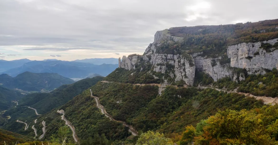
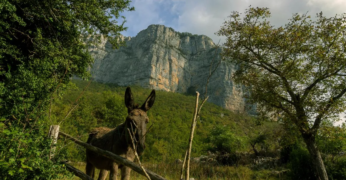
The karst area of the Vercors mountain range is located in the foothills of the French Alps, bordered on the east by Grenoble and on the west by Valence in the Rhone Valley.

Contributed by
It is an insider’s tip that found this location where tourism has grown very slowly. There is barely any industry, and there are no congested roads, no large concrete tourist centers and just one small supermarket. Quiet and contemplative, the area is characterized by traditional crafts, agriculture and tourism. The region is frequented by scientists and mountaineers, hikers, base jumpers, speleologists, bat researchers and cave divers.
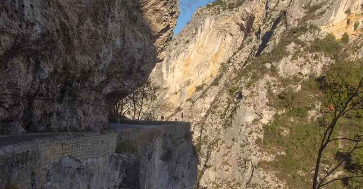
The access road to the area penetrates the narrow gorges, where the restricted roads were partially carved out of the rock to form tunnels. Coming from the south via the little village of Die, the road serpentines up the slopes of the plateau. Only size-restricted vehicles are authorized to use this road.
Tourists in buses are therefore excluded. The Vercors, divided into two parts by the canyon of the river, La Bourne, comprises an area of approximately 1,350 sq km: the north, which has opened up and been developed for tourism, offers all kinds of sporting activities; and the south, which is still wild and pristine.
Flora and fauna
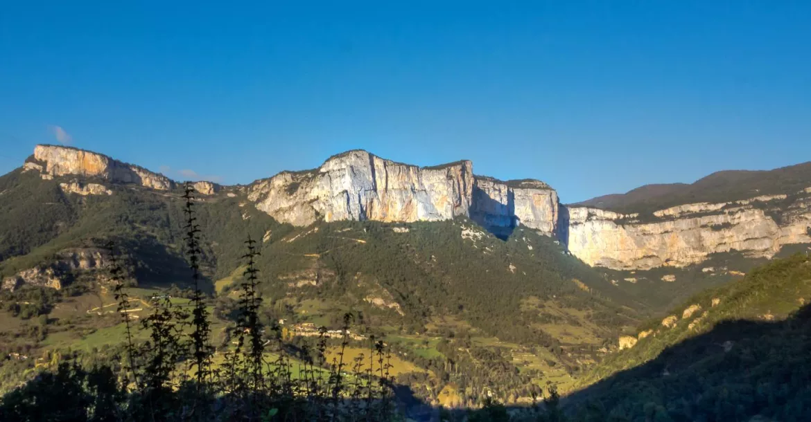
In the early ‘70s, Vercors was declared a natural preserve. As for flora and fauna, one will find alpine plants and animals that are eradicated elsewhere in Europe. The plateaus and valleys provide habitat for eagles, various birds of prey and vultures, alpine ibex and marmots. More recently, lynx and wolves have also been resettled here.
Alpine plants such as edelweiss, gentian and carline thistle occur there, but a special feature are the 60 species of orchids, of which the well-known lady slipper's orchid is only one. The Vercors boasts some 2,000m mountains, of which Mont Aiguille at 2,086m is not the highest, but probably the best known, as it was the cradle of Alpinism.
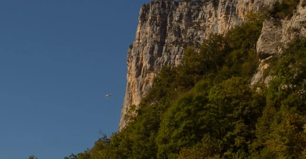
It was in this region that alpine mountaineering was "invented" in the beginning of the 15th century by Charles VIII. At that time, the mountain was conquered by ropes, hooks and ladders. Even today, many hikers and climbers come to the region, which by its status as a nature park, still shows a reasonably intact natural mountain landscape.
Caves
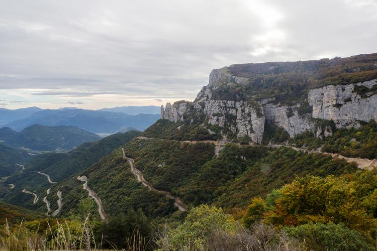
Particularly impressive in this region is the karst system with its natural attractions: the numerous stalactite caves with their bizarre structures of calcium deposits. Five caves have so far been made accessible to visitors: Grotte de Choranche, Grotte de Thaïs, Grotte de la Luire, Cuves de Sassenage and Scialet de Draye Blanche So, how did the karst area in the Vercors and these stalactite formations develop?
In the Mesozoic Age—about 250 million years ago when this area was still below sea level—reef limestone was formed and layers of marine deposits were created. This included snails, mussels and other marine life (now visible everywhere as fossils in the different rock layers).
In the Tertiary period, about 65.2 million years ago, rises and folds through tectonic plate processes were produced by the pressure of the African plate on the Central Europe plate. Today, we can see the effects of these processes evidenced in the more than 300m steep cliffs and drop-offs of the plateaus. Rainwater, seeping through the plateaus, has carved out the wonderful formations in the caves.
In a nutshell, this process can be explained as follows: Carbonated calcium is released from the limestone, caused by carbonic acid in the water, and corrosion takes place. Deeply penetrating water leads to leaching of dissolved calcium carbonate, thereby forming large cavities in which water collects and flows. At the same time, a reverse process takes place.
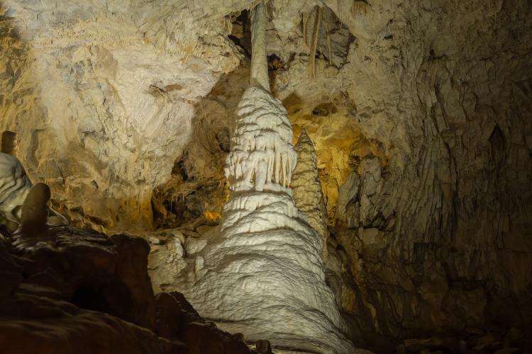
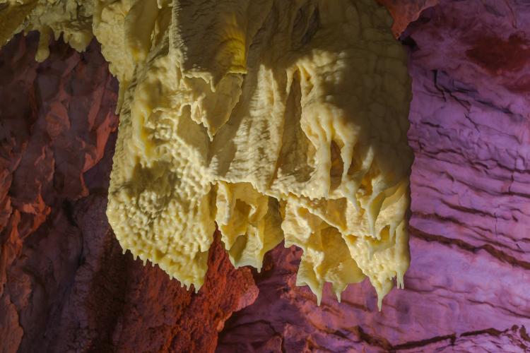
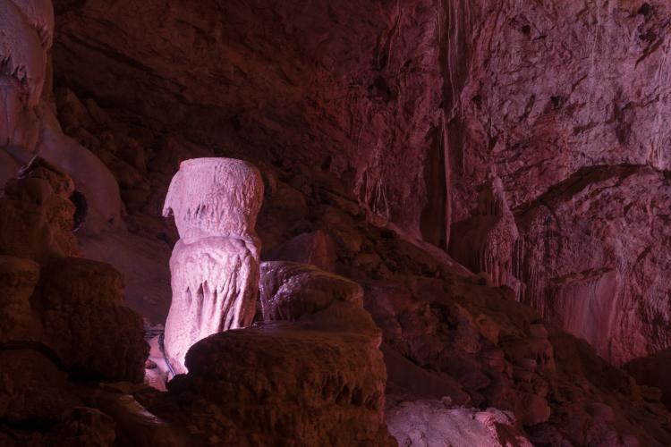
The lime-saturated solution dripping down from the cave ceiling leaves deposits on cave ceilings and floors, which form into stalactites and stalagmites after millions of years. The calcareous water forms gutters when flowing on the ground, some of them also have bizarre shapes. These wonderful and unique formations attract many visitors.
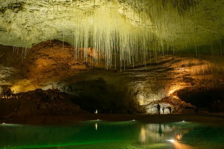
Choranche Cave
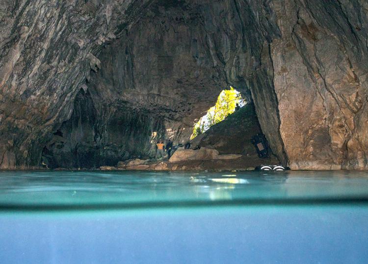
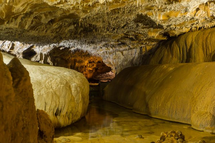
As can be clearly seen on the 3D model in front of the cave of Choranche, the water runs off and only gets out above the ground when it strikes a waterproof barrier. Until then, the water flows predominantly vertically through a 300 to 500m thick limestone layer. It is crystal clear and filtered—of the highest water quality. The cave of Choranche was discovered in 1871, when during a draught, the inhabitants of Choranche were searching for the source of the Gournier River.
Water came out of a gap in the rock. After having cleared away loose scree, the inhabitants found a narrow corridor that ended in a large hall with a subterranean sea. The two underground rivers, Coufin and Chevaline, flowed together here. During the draught, there was access to this hall.
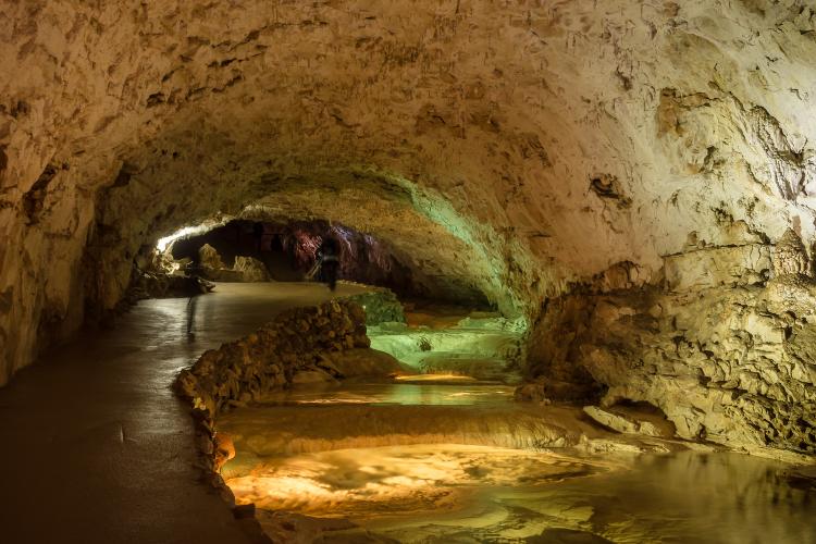
Only 20 years later, the pioneer and speleologist Oscar Descombaz (circa. 1866-1914) explored the caves of Choranche—after the water level had dropped again in another period of draught. Today, about 100,000 people per year visit the cave of Choranche and explore the natural wonders on paved paths and under the supervision of the cave guides.
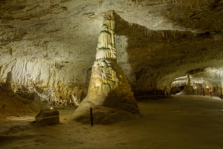
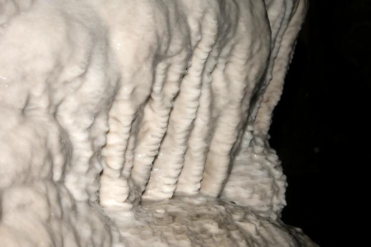
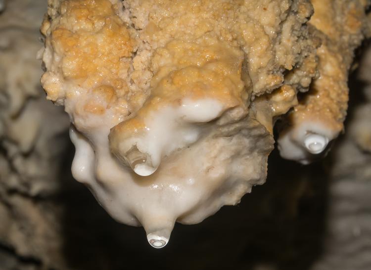
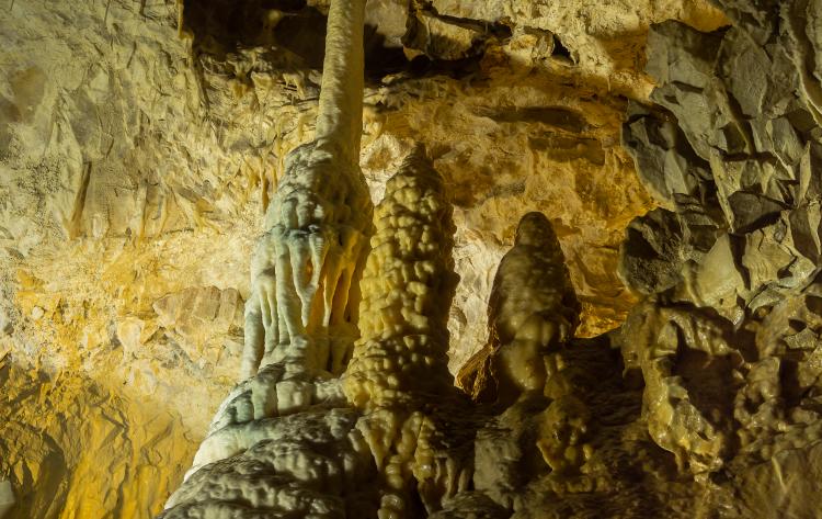
The part opened for tourism is well-lit and spectacularly staged, since 2013, with modern LED technology. The peculiarity of the Grotte de Choranche are the numerous thin fistula that hang from the ceiling like straws, growing only approximately 5cm over 100 years.
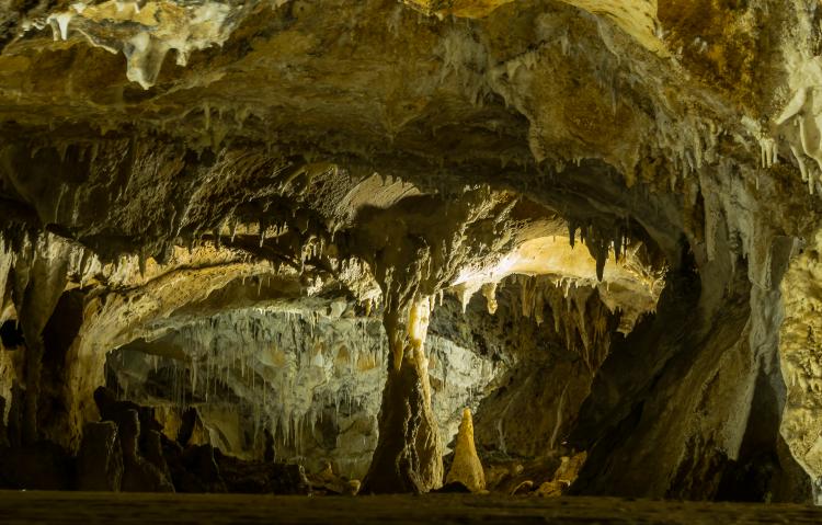
These fistula resulted from the constant flow of water in the grotto, as the water descended slowly, but continuously in these tubes. The longest of these fistulas has a length of 3.2m. Stalactites and stalagmites in this cave are of different sizes and lengths, and some have grown together over millions of years into large columns.
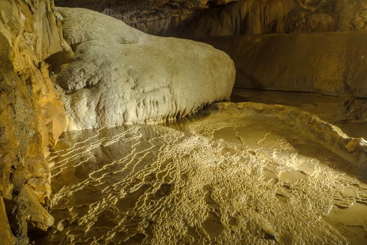
In the "cathedral" of the cave system—an impressive space around 50 by 80m in size—there are numerous terraced formations cascading down like stairs. These are round gours, or rimstone dams (cave formations of calcite), into which water drops steadily from the ceiling. The water then accumulates in underground lakes, which flow out through these gours—a bizarre world is formed.
Bournillon Cave
The Grotte de la Luire at 45km is the longest cave system of the Vercors. During wet seasons, the level may rise up to 450m in this transitional system. It drains into the Grotte de Bournillon, an impressive cave near Châtelus with a ceiling height of 140m.
The size of the cave opening is very impressive, especially the pink rocks of the vaulted ceiling that forms the largest cave in Europe. Nearby, the largest waterfall in Europe, at 320m in height, can be seen. Here, water rushes down from the semi-circular cliffs of the Cirque du Bournillon and then merges with the water from the cave river.
Civilization has taken advantage of the huge volume of water passing over the great height of the cliffs here, with a power plant generating electricity. Further down the valley, the water is dammed again, and the resulting reservoir serves as a water supply for the region.
Unique species
In the part of the Bournillon cave that is not accessible to the public, speleologists have found eyeless and non-pigmented crabs, catfish and other species. As eyes and pigmentation are not useful in a dark environment like a cave, creatures have evolved other sensors such as antenna or whisker-like barbels to scan the environment, and thus to “see” in the dark.
The animal most associated with caves, the olm (proteus) or aquatic salamander, is found in Choranche only sporadically in underground pools, as it is endemic only in the caves of the Balkans in what is now Slovenia. In other regions, these creatures are not to be found, unless they are exhibited in aquariums.
The pigmentless species is about 35cm and eyeless and can live up to 60 years. At birth, its eyes are present, but they wither away rather quickly and are no longer recognizable later in the animal’s life. The space over the water surface in the numerous caves is almost exclusively settled by bats, of which there exist about 30 species in the Vercors—an ideal retreat for light-shy animals.
There are regular guided tours for tourists and school groups to see these species under the guidance of skilled specialists. A recently discovered endemic insect in the caves of the Vercors is a species of longhorn beetle. However, there is still not much published about it.
Caving
Where the cave stops for day visitors, begins the domain of speleologists, archaeologists and researchers. In the Choranche Cave, which has been studied the most extensively so far, a transitional system of 33km in length has been explored. Scientists can penetrate this system within six to eight hours. The only access is through the so-called "siphon", a sump in an underwater part of the cave of the Choranche. Passages, corridors and tunnels lead to differently-sized cavities with pockets of air on different levels. The exploration is still ongoing and will enhance the knowledge of this system. Anime Drifters Season 2 —
What do we know? Release Date, Plot And Cast. Any further exploration attempts are recorded and documented on maps. However, access is limited to 10 to 20 times per year, even for the French Federation of Speleology, in order to keep the cave system in its natural, pristine state.
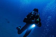
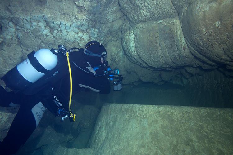
Diving
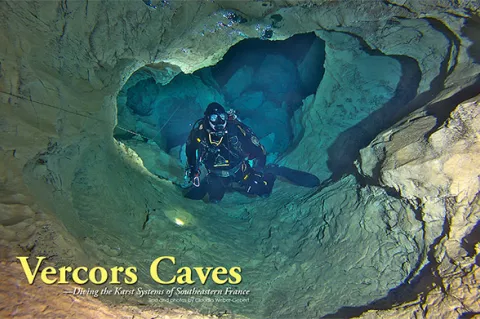
Where water, rivers and lakes are present, one can, of course, go diving. One, who has found his niche in the large number of diving centers in France, is a native of the Vercors—William Thumy (www.vercors-plongee.com). Since his youth he has had a passion for cave diving in the caves and the crystal clear rivers of the Vercors.
His diving center, Dive Xtreme, specializes in conducting dives in the caves, grottos and rivers as well as ice diving, with different levels of difficulty. Even with the scientific explorations in the various caves, he is often involved and is knowledgeable about the latest state-of-the-art technology employed on these expeditions.
Gournier Cave
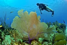
In the cave of Gournier, which is not far from the cave of Choranche, you can dive autonomously. Here, however, the equipment must be carried to the cave entrance. The water is consistently cold, about 8 to 10°C and crystal clear. A drysuit is highly recommended, but not necessary. Experience in night diving and good buoyancy control are clear advantages here.
In this huge cave where the water is 3 to 5m deep, you can see stalagmites on the floor, and there are stalactites hanging from the ceiling of the cave. The walls have structures of calcium deposits that are common for caves—a sign that the water level must have been much higher even over long periods. One particular feature is the "Medusa" on the wall, a stalactite formation that has a jellyfish shape and is a real eye-catcher.
At the rear end of the cave, where the underground river enters, the cave becomes more and more narrow and the ceiling becomes increasingly flatter. There is a slight current towards the cave exit. On the back wall, you can see a sort of gutter and sinter pools through which the water drained in earlier periods. Normally, the water is crystal clear, if sediment has not been stirred up by some divers previously.
However, with the constant light flow of incoming water, the suspended particles are transported towards the cave exit, and after a short time, the visibility is good again. Not to be underestimated are the lighting conditions in the cave, which are comparable to a night dive. Although light is incident from the cave entrance and the walls are bright, the light is swallowed by the huge size of the cave of Gournier and in the water no light remains. Good torches are recommended!
Exploration and findings
The Gournier is considered to have the most beautiful underground river in the world. Its course can be tracked up to 15km. Time and again, galleries open along its course, with waterfalls and pools connected by gours and gutters. With ropes, ladders and hooks, scientists have now penetrated deeper and deeper.
Some videos about their expeditions in this cave can be seen on YouTube on the Internet. Barnabé Fourgous, a French scientist, has found the fossilized skeleton of a bear that was extinct more than 30,000 years ago. Due to the conditions in the cave, the skeleton is very well-preserved. In some parts of the cave system, one can also find evidence of prehistoric people.
More specifically it is only by diving into the water-bearing passages themselves that these findings can be made. To do so, one must have previous experience in cave diving and the appropriate training. Not everyone is allowed to dive in these areas, and only under leadership.
Here again, William Thumy is the right partner for divers who want to undertake this adventure. From narrow, water-filled tunnels to spacious rooms with airy chambers, the cavities are always connected by underground rivers and tunnels. Few fearless explorers can dive this unique wonderland and admire the bizarre limestone structures underwater. Technical equipment is required.
One should always ask in advance, what requirements are imposed. Based on the section of the Grotte de Thaïs (established by Yves Billaud) one can clearly see the difficulties in extreme cave diving: the way is long and partially narrow and the return trip must be counted in. As the previously explored part of the cave has a difference in altitude of about 90m, an advanced decompression procedure is required.
Most of the time, only scientists are found studying, exploring, documenting and going even deeper into the various caves. All scientific studies are coordinated by EDYTEM (Environnements, Dynamiques et Territoires de la Montagne, or Environment, Dynamics and Territories of the Mountain), an association of the CNRS (Centre National de la Recherche Scientifique or National Center for Scientific Research) and the University of Savoi, consisting of speleologists, archeologists, geologists and geographers.
People of the Vercors
Artefacts and human remains from prehistoric ages document the fact that the region has been inhabited by human beings for a long time. The caves offered protection against the cold and water was available in abundance. There were also animals such as deer and ibex, which could be hunted. Marmots served as a source of fat and furs. However, proof of real settlement was found rather in the deeper parts of the Vercors. During the Second World War, the Vercors served as a refuge for the people from the Resistance.
Some Medieval castles have been irrevocably destroyed during that period. Today's villages in the Vercors have a more rural character, with no big supermarkets but lots of small shops where one can buy specialties of the region such as goat cheese, dairy products, walnut products and handicrafts. Hotels are reasonable in price, small and personal, and accommodations can also be found on many isolated, out-lying farms.
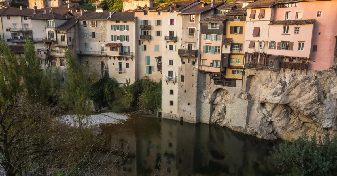
Even today you can find evidence, like in Pont-en-Royans, that civilization has come to terms with water and taken advantage of this resource. The tiny village of Pont-en-Royans was one of the first places in France that had its own power supply. Until the ‘60s, parts for electric installations were produced in this village. In the Museum of Water, you can have a look at the entire history concerning water in this region. ■
Claudia Weber-Gebert is a cave diver, underwater photographer and dive writer based in Germany.


")