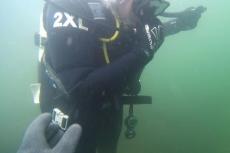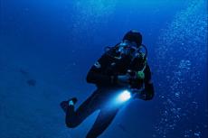
Arus kencang are the words you need to listen out for—you will hear them in the rapid interchange between the dive guides and the boat boys, as they discuss the practicalities of safely immersing a group of “bule” (slang for foreigners) in the waters of Raja Ampat.
Arus kencang means strong current in Bahasa Indonesia, and the emphasis given to those two words will give you an instant insight into what awaits you below.

Contributed by
Factfile
Diving in Strong Currents
—The Do’s and the Don’ts
The trick to diving in strong currents around Raja Ampat is to understand the basic mechanism and work with it, because you just can’t fight it. Strong currents are the life-force of vibrant reefs systems, and they are at the strongest around the edges and at their most manageable in the center.
Picture a large submerged bommie or pinnacle that rises up from the deep and faces into the predominant current. Where that current hits the reef first is where its velocity is low, and the deeper you go at that point, the less that velocity will be. But as the current goes around the sides, the velocity increases dramatically, and where it goes over the top of the bonnie or pinnacle, particularly if it is shallow, the velocity is at its maximum.
So, when you enter the water, it should be upcurrent from the bommie, and you must get down on the front as quickly as you can, which is the sweet spot where the current is manageable and where the most prolific fish activity is. Miss the front, and you will think you are in a washing machine, as the currents sweeps you around or over the top. ■
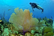
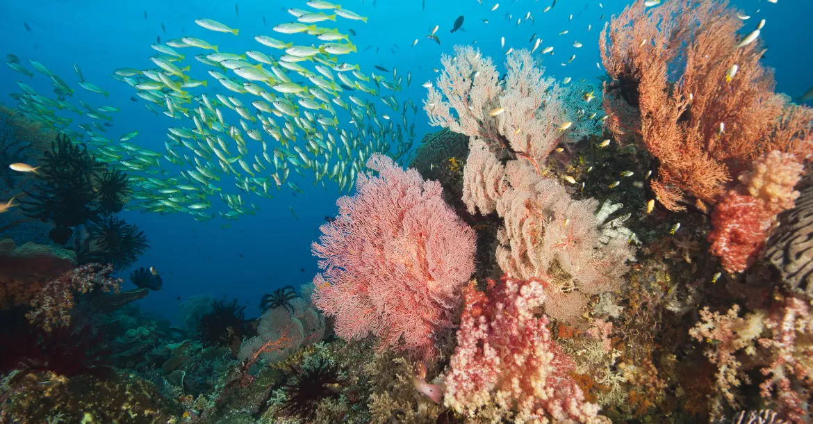
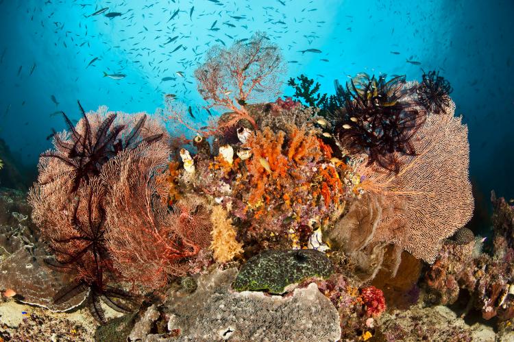
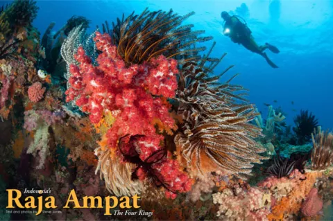
The incredible reefs and tremendous biodiversity of the Raja Ampat area have made this remote part of the Indonesian archipelago one of the hottest dive locations in the world, and those currents are the very lifeblood of the area. For they carry the rich nutrients from the deep basins of the Pacific Ocean to the northwest of Raja Ampat and have helped to create what are generally considered to be the finest coral reef ecosystems in the world.
The amazing biodiversity of the area, and the currents that flow through it, are two sides of the same coin, and a basic understanding of this mechanism is the key to truly enjoying one of the best diving experiences there is.
Location, location, location…
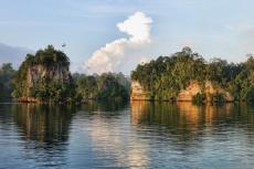
The remarkable landmass of New Guinea is the largest tropical island in the world, and it sits just below the equator along the southern rim of the “Ring of Fire”—the belt of volcanoes and tectonic plates that runs around the edge of the vast Pacific Ocean.
Divided by colonial legacy and cold-war geopolitics into two roughly equal halves, the eastern part of the island is the independent country of Papua New Guinea (PNG), while the western half, which is now generally known as West Papua, became part of Indonesia in 1969. Although occupying less than half of 1% of the Earth’s surface, the island contains up to ten percent of the planet’s species and is a veritable storehouse of biodiversity.
The waters that surround New Guinea offer some of the very best diving in the world, with PNG long-established as a diver’s Mecca, but it is Raja Ampat on the northwest tip of West Papua that has become the place to have in your logbook.
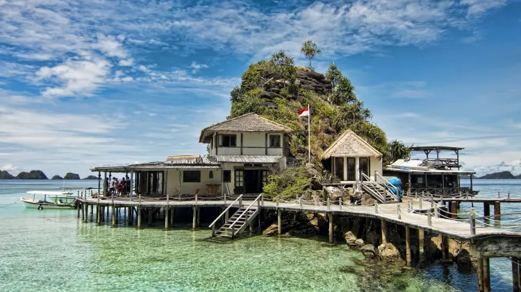
Just ten years ago, your choices were limited to one dive resort and a couple of liveaboards, but now there are several well established resorts and up to 50 boats operating in the area at the peak of the diving season.
Thanks to the excellent work of Conservation International, The Nature Conservancy and WWF-Indonesia a network of 12 marine protected areas (MPAs) have been established in West Papua to counter the impact of tourism and over-fishing. These marine protected areas cover an area of almost 3.6 million hectares, or 25 percent of Indonesia’s total national MPA coverage, and have played a major role in keeping the underwater environment in excellent overall condition.
More recently, in February 2013, the local government of Raja Ampat declared four million hectares of coastal and marine waters as a sanctuary for sharks, manta rays, dugongs, whales, dolphins and turtles—tacitly recognizing that these creatures are much more valuable alive than sold as by-catch.
The Four Kings
Raja Ampat means four kings in Bahasa, and the name comes from the local myth of a woman who finds seven eggs, four (ampat) of which hatch and become kings (rajas) and occupy four of the area’s biggest islands, whilst the other three become a ghost, a woman and a stone.
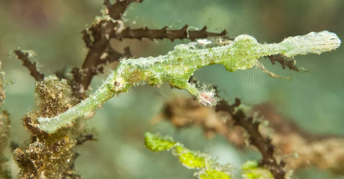
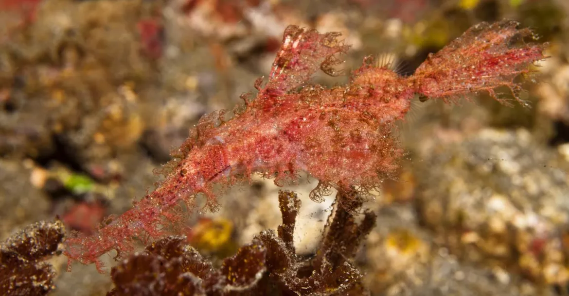
Those four islands are Waigeo, Salawati, Batanta and Misool are surrounded by about 1,500 smaller islands and about 40,000 squ km of water. Surveys of the area have identified over 600 species of hard coral, which is nearly 75 percent of the world’s total, and in excess of 1,700 species of reef fish—more than any other similarly-sized region on the planet. Raja Ampat truly is the global epicenter of marine biodiversity!
Diving Raja Ampat
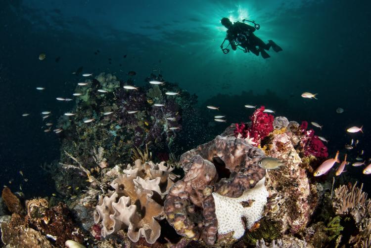
There are three principal areas to dive in Raja Ampat: in and around the Dampier Strait that separates the main islands of Waigeo and Batanta; Waigeo itself; and the area around the island of Misool in the south. Triton Bay on the south coast of the main island is also technically part of the Raja Ampat area, but its remoteness means that it is treated as a separate trip.
All three areas offer spectacular diving and underwater experiences, which could fill a couple of books, but there are certain signature dives in each area that really should not be missed.
The Dampier Strait
The dives sites of the Dampier Strait are where most liveaboards start and finish their diving programs, because they are the closest to the town of Sorong and its airport, which is currently the point of entry to the Raja Ampat area.
For those of you familiar with fluid dynamics, the Dampier Strait can be thought of as a venturi, where a restriction in diameter automatically increases the velocity of the fluid passing through it.
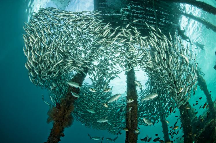
For all the rest of us, think strong currents—because the Strait is the principal channel through which the flow of water from the Pacific Ocean passes through on its way south. These currents and the rich nutrients in the water have created some of the most spectacular reefs, bommies and encounters you are ever likely to experience.
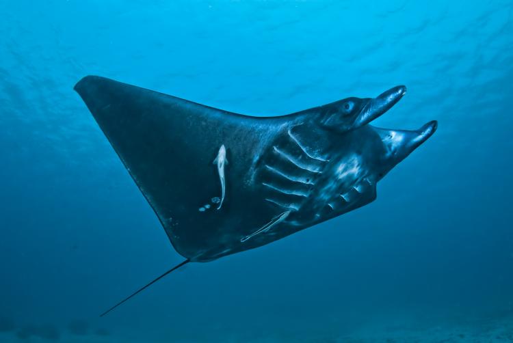
Manta Mantra. Variously referred to as Manta Mantra, 3M, Manta Ridge and Manta Sandy, this site is a manta ray cleaning station on the southern side of the large reef that separates Mansuar Island from the much smaller Airborek Island at the western end of the Dampier Strait.
The cleaning station is a number of small bommies located in the channel between the main reef and a smaller one to the south. Strong currents run through the channel, which together with the numerous cleaner wrasse and butterfly fish on the bommies, have created the perfect conditions for mantas to come in and be cleaned of their parasites. As many as 30 mantas have been reported on the site, but on the days I dived it we saw between five and ten—but on every dive.
The site is very popular, and to ensure the presence of so many divers does not drive away the mantas, a strict demarcation code is enforced at the site. A line of rocks has been laid out in about 16m of water, close enough to the bommies so that divers can observe and photograph the mantas, but far enough away to allow them to be cleaned in relative peace.
The thing to do at Manta Mantra is get yourself in position somewhere along the demarcation line where you can comfortably hold on against the currents and then wait. The site is fairly shallow, and so bottom time is not an issue. As the mantas complete their cleaning rituals, they often come and check out the waiting divers with some upfront and personal interactions. Altogether a tremendous dive site and not one to be missed!
Airborek Jetty. Another signature dive site that should not be missed are the two jetties on the small island of Airborek. Here, the Dampier Strait currents flow around the jetties, creating a mini-ecosystem on the wooden structures, with rich growths of vibrant soft corals on the vertical piles and resident schools of jacks and batfish patrolling in between.
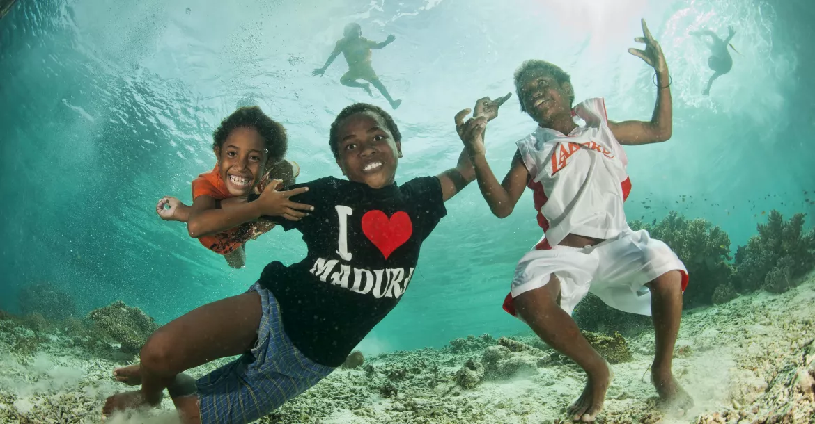
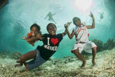
Late afternoon on a calm day produces a perfect setting for wide-angle photography as the sun’s rays create stunning backdrops to the abundant subject matter under the jetty. Then, if you tire of that, the local kids make excellent models as they swim down to pose for the camera.
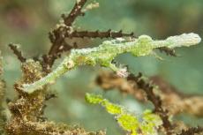
Down in the coral rubble on the slope around the jetties, you will find jawfish, pipefish and other critters, while the bommies at 18m are home to some schooling sweetlips and numerous critters.
Mioskon. This small island on the northern side of the Dampier Strait is near where the southern end of Kabui Bay exits in to the strait between the large islands of Gam and Waigeo. There are several other superb dive sites in the area, such as Cape Kri, Sardine Reef and Mike’s Point, but for sheer consistency the eastern side of Mioskon is hard to beat.
Known above water for its large population of flying foxes, below water you will find a superb reef with numerous bommies densely coated in soft corals and a resident school of yellow snapper patrol that sweeps up and down the reef in a flowing motion that adds to the very dynamic feel of the site.
Throw in the numerous wobbegong sharks to be found and the plethora of creatures and critters in amongst the bommies and soft corals, and this is one tremendous site that can be dived time after time without getting bored.
Waigeo—The Passage
In the northern area of Raja Ampat, around the western tip of the island of Waigeo are several good dive spots such as the critter site Waterlogged and the nearby Pearl Farm jetty in Alyui Bay. But the narrow channel that separates the islands of Gam and Waigeo is very much the signature dive in Waigeo.
The channel’s proper name is Kabui Passage, and it connects the western side of Kabui Bay to the Halmahera Sea, but it is universally referred to as simply The Passage.
Roughly one nautical mile long, The Passage is about 60m wide and is subject to some really strong currents that can make the journey through it feel a little bit like white rafting!
Although it looks just like a fast flowing freshwater river making its way through dense jungle, it is actually sea water, and in the many small inlets along the side of The Passage, mini-ecosystems have been established. These are quite special, particularly the ones on the southern side near Kabui Bay where large sea fans, soft corals and colorful sponges have grown in shallow waters under the overhanging jungle creating quite unique photo opportunities.
Diving The Passage around midday offers the chance to capture the sun’s rays, as they pierce the overhead canopy and illuminate the colorful growth below creating a superb and mysterious effect.
Then, there are the mangroves and archer fish hunting their prey in their unique “spit-and-stun” technique and small schools of halfbeaks up in the inlets, but don’t forget to look out into The Passage itself, as you will often see passing sharks, turtles and jacks—what a dive!
Local knowledge
The indigenous people of the Raja Ampat area predominantly live in small coastal colonies where the traditional tribal culture, which revolves around the sea, still prevails. Apart from tourism, there is virtually no industry, which means that the sea is the principal source of sustenance, but extracting that bounty from the rich waters of Raja Ampat requires a quite unique skill set—one which, when learned, is ideally suited to safely immersing “bule” (tourists).
Mikel Merin from Dome Island near Sorong has been the principal boat boy on all the trips I have done to Raja Ampat—which have been with Deb Fugitt’s City Seahorse dive travel company. Fugitt has been leading trips to Raja Ampat since 1999 and met Merin on that first trip, when he helped her find the best spots to dive safely.
Watching Merin study the surface currents and direct the cover boats is to observe somebody who is comfortable with these forces of nature and can intuitively understand what is happening under the water from the patterns above. Those skills are past down from generation to generation by the people of Raja Ampat, as they learn how to take their canoes out in to the currents of the Dampier Strait, understand where the fish will be, how to catch them and (most importantly) how to get back to the village with that catch.
Merin sat with me one evening on my last trip to Raja Ampat and explained how his uncle had mentored him from an early age to do this by first showing him how to paddle his canoe with and against the currents, then how to interpret the state of the tide from the phase of the moon—no clocks or tide tables required.
Once confident on the water, the next steps were to read the surface patterns created when the currents sweep around a reef or large bommie, so that the canoe can be safely anchored in the sweet spot closest to the fish.
Merin also shared with me stories of what had happened to him when he got it wrong in the early days, as he started to go out by himself. One misadventure he related had him caught in the fierce currents of the Sele Strait between the islands of Batanta and Salawati, as night was falling.
He managed to turn his canoe around and make it back to Dome Island by dawn the next day, but had he not, he would have been swept out into the Halmahera Sea with the next chance of landfall some 300km away—character building.
Misool
Some 130km to the south of the Dampier Strait area, and roughly halfway to Ceram in the Molluccas, is the large island of Misool and what are probably the very richest and most vibrant reefs in the world. This is a remote area in a remote area, and Misool’s isolation has allowed it to become the epicentre of biodiversity in an area that is already recognised as the most biodiverse in the world.
It is hard to imagine a more picturesque and inspiring area, both above and below the waters. But it is not like this by accident, and much of the credit for the current excellent status of the area’s reefs and marine habitats are the results of the conservation work pioneered by the Misool Eco Resort. A superlative example of what can be done to arrest decline and convince local communities that the seas are not an inexhaustible resource, the resort has really done a tremendous job and is to be applauded.
Fiabachet. Is this the best reef in the world? Hard to answer in a quantifiable manner, but subjectively, Fiabachet has to be in the top ten if not the top five—it is simply that good!
There are numerous other tremendous sites in a string of islands to the southeast corner of Misool, but Fiabachet is the jewel in the crown and a simply amazing experience. The actual site is a long underwater ridge that runs west to east and connects two rocky outcrops: Nudi Rock at the western end and Tank Rock at the eastern end.
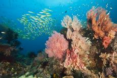
The underwater area around Nudi Rock, which takes its name from the remarkable similarity its above water shape bears to a nudibranch, is positively stunning and probably the best and most dynamic part of Fiabachet. The quality and quantity of the hard and soft corals, sponges, gorgonian fans, sea whips and general fish life will take your breath away!
But the area around Tank is phenomenal as well, and if you went there first, you would probably think it can’t get much better than this, only to journey down the ridge to Nudi and find somewhere that takes it to the next level. Once upon a time there were many other places just like Fiabachet.
Batu Boo. It’s hard to pick the next best dive site after Fiabachet, as there are so many to choose from, but nearby Batu Boo is quite something, too. It is also known as Boo Windows because of the two large, shallow underwater holes in the main island that create excellent photo opportunities at certain times of the day when the sun streams through them. The site is a large underwater seamount that runs north to south, and at the northern end, there is a large oval shaped rocky outcrop, while at the southern end there is a small outcrop with a single tree growing on it—which has been christened Batu Jamur, or mushroom rock, for obvious reasons. The two “windows” are at the southern end of the main rock and face west to east, making them perfect for the sun’s rays.
Besides the windows, there is a great deal to see at Batu Boo, starting with the walls of the seamount that is richly covered in soft corals and gorgonian fans—many with pygmy seahorses. The blue water around the rock is host to numerous pelagic fish, and the area around Batu Jamur is rich in soft corals and has a resident school of yellow snappers.
Conclusion
The Four Kings is without a doubt one of the top dive destinations in the world, and the danger is that its very popularity will severely degrade its tremendous biodiversity. While there are signs of degradation, there are also significant efforts being made to arrest the decline, and the work done by Conservation International, The Nature Conservancy and WWF-Indonesia together with the very hands-on and proactive approach of the Misool Eco Resort is tremendous.
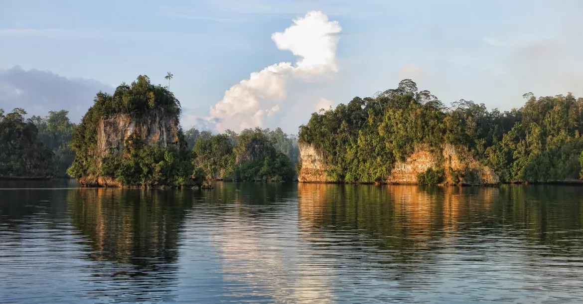
The creation of the huge marine protected areas (MPAs) and shark sanctuary indicates that the local authorities are getting the message that a healthy and vibrant Raja Ampat is much more valuable that a plundered one. The area’s spectacular above-water scenery would justify the long journey to get there in itself, but for divers, Raja Ampat offers a chance to see the underwater world at its very best and is something you simply should not miss! ■
Don Silcock is a Bali-based underwater photographer and writer who focuses on the diving in Indonesia and Papua New Guinea. His images, articles and extensive location guides can be found online on his website: www.indopacificimages.com
Published in
- Log in to post comments


")