The southern coast of the large island of New Britain in Papua New Guinea is a truly remote location isolated from the northern coast by high, rugged mountain ranges with no real roads through them. There are no commercial airports here—only landing strips and old WWII airfields used for small-scale charter flights. Practically, the only way to get to the southern coast is by boat from Rabaul, on the eastern tip of New Britain.
Contributed by
Factfile
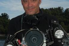
Asia correspondent Don Silcock is based in Bali, Indonesia. For extensive location guides, articles and images on some of the best diving locations in the Indo-Pacific region and “big animal” encounters globally, please visit his website at: indopacificimages.com.
It involves a long and usually overnight journey, which will take you down through the St George’s Channel, in-between New Britain and nearby New Ireland. The channel needs to be navigated with respect, as there are some fierce and complex currents flowing through it. It is a journey that Alan Raabe, the skipper and owner of MV FeBrina, has been making regularly for well over 20 years, but only for a few months of each year, during the dry season in the south when pristine underwater visibility returns.
Alan has been exploring New Britain and many other parts of Papua New Guinea since 1991 and it is a basic fact that nobody knows those areas as well as he does. Interestingly enough, he considers the southern coast as one of the absolute gems of Papua New Guinea diving.
Waterfall Bay
As we emerged from St George’s Channel, the journey to the southern coast became both tangible and inspiring, as the sheer size of those mountain ranges could really be appreciated for the first time. Dense rainforest seemed to cover everything, and I wondered how it was possible to survive in such a remote place.
We finally arrived in Waterfall Bay—the first port of call on the southern coast. Clearly, they do not get a lot of visitors here; very quickly, the back of the boat was surrounded by canoes from the local villages. Some had women selling fresh vegetables, a few had curious men, but most had kids who were very excited to see us.
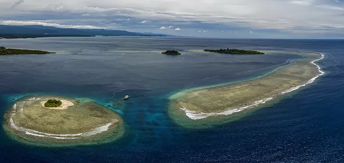
There were two main areas to dive in Waterfall Bay: The Mocklon Islands on the western tip, near Cape Kwoi, and around the jetty at the village of Matong. Both offered quite different, but really interesting, experiences.
Mocklon Islands. The location of these two islands (one large and one small) meant they were exposed to the powerful, nutrient-rich currents of the Solomon Sea. Those currents fed and nourished the vibrant fringing reefs around the islands, and there were several sites from which to choose. Where we actually dived depended on the time of day and the prevailing current. But overall, the diving was really nice, with healthy reefs and interesting sandy slopes that hosted intense patches of cabbage and other hard corals.
Matong Jetty. This small pleasant village was located on the eastern side of Waterfall Bay, not far from the Mocklon Islands. It was well worth taking the time to go for a walk around Matong, as the village was well kept and the people were open and friendly. The villagers were particularly proud of their school, which had received quite a lot of support from AusAid.
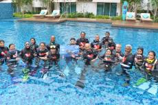
But it was the jetty at Matong that got one’s full attention. And you have two choices when diving it. Firstly, you can put on your macro lens and go fossicking for critters in the accumulated flotsam and jetsam; or you can go wide-angle and take advantage of the endless stream of young swimmers, vying for your attention. The jetty seemed to be the place to go after school, with all the kids performing competition acrobatics off it.
So, when divers turned up with underwater cameras, it generated a great deal of excitement and it did not seem to matter that the kids could not see the actual results. Their reflections in the dome port were enough to keep them energised for hours! Signaling them to come closer to fill the frame had them almost bumping into the dome. The sheer exuberance of the kids at Matong village jetty was what made the place so special. Sure, the photo opportunities were great, but they were not unique; however, rarely will you find such willing and enthusiastic models!
Linden Harbour
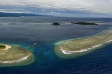
Roughly halfway along the southern coast of New Britain was the incredibly photogenic location of Linden Harbour, with its superb lagoon, bounded by a series of outer barrier reefs, which provided an excellent safe anchorage. In-between those barrier reefs were astonishingly rich channels, which offered some of the very best diving on the southern coast. Add in a few beautiful reefs inside the lagoon and a WWII aircraft wreck, and one could see why Linden Harbour is rated so highly.
Overall, there was a lot to see and enjoy underwater in Linden Harbour, but without doubt, the number one thing that will stay with you from diving there will be those channels. Much of southern New Britain is swept by the currents of the Solomon Sea, rich with nutrients swept up from the deep basins and trenches to the south. And it is those nutrients that are the life source of the marine life and reefs of the southern coast. But with the channels at Linden Harbour, the daily tides bring in that rich water at considerable velocities, creating the perfect conditions for marine growth to flourish on an all-you-can-eat smorgasbord.
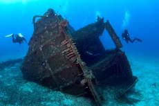
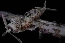
At the other end of the spectrum was the wreck of the Japanese WWII “Jake” seaplane, which rested on its back in the lagoon by Poronga Island. In just 18m of water and easy to dive, the wreck was a great counterbalance to the vibrant channels and reefs of Linden Harbour.
The East Channel. Diving the eastern channel at Linden Harbour on an incoming tide was simply spectacular. The walls of the channel were covered in a rich marine growth of fans, sponges and soft corals. Scattered across the bottom of the channel were several incredibly beautiful bommies. Although the incoming tide brought clean water from the deep waters to the south, as the channel narrowed, it delivered them at a considerable velocity—so, you can easily find yourself rocketing along. The trick was to duck behind one of the bommies and enjoy the scenery.
Elsie’s Reef. Located inside the lagoon at Linden Harbour was this exceptional reef named after one of the former dive guides on MV FeBrina. Elsie’s Reef was a crescent-shaped reef that started at just 5m and then sloped down gently before dropping off into the depths.
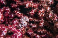
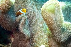
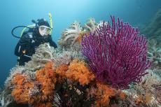
There was much to see on the reef with beautiful elephant ear sponges, gorgonian sea fans and incredibly colorful crinoids. In particular, the shallow area on top of the reef at Elsie’s was a great place for wide-angle photography, with excellent light, clear blue water and an abundance of vibrant subject matter to fill the frame.
Jake seaplane. At ground level, there were almost no signs that Linden Harbour was a Japanese seaplane base during WWII. But from the air, it was easy to see why its sheltered lagoon would have made it prime real estate, which, combined with its strategic location on the southern coast, would have made it an excellent place from which to operate.
Not a great deal is on record about those operations, but there are a few aircraft wrecks that have been found in the lagoon, the best of which was a largely intact Aichi E12A1 “Jake” seaplane. The plane rested on its back, with one of its two floats pointing to the surface, in 18m of water just off from Poronga Island. The plane was relatively intact, apart from the second float, and although it was not that big, it still made for an excellent dive. Exploring the wreck was really a straightforward and interesting dive, but one should not miss the open bomb bay, with its open doors and quite large ordnance plainly in sight for all to see.
The name “Jake” comes from how the Allied Forces identified Japanese aircraft during WWII, as the actual naming convention was both difficult to understand and pronounce. The Japanese gave two names to each aircraft, with one being the manufacturer’s alphanumeric project code and the other being the official military designation. So, code names were used by the Allies instead, with western men’s names given to fighter aircraft, women’s names for bombers and transport planes, bird names for gliders and tree names for trainer aircraft.
Afterthoughts
Papua New Guinea is an amazing country with some incredible diving, but there are very few places that can match the southern coast of New Britain.
Currently, there is really only one choice if you want to experience the southern coast of New Britain—and you should, if you enjoy great diving with a good slice of adventure! The MV FeBrina does nine-day trips to the southern coast every February and March, starting and ending in Rabaul. ■

