Expedition Explores Previously Uncharted Deep-sea Coral Reefs

Scientists from NOAA, University of North Carolina Wilmington, Marine Conservation Biology Institute, and partner organizations returned yesterday from a 15-day expedition aboard the NOAA Ship Ronald H. Brown exploring previously uncharted deep-sea coral sites off the east coast of Florida.
Marine life samples collected and new maps created from the mission will guide management of important deepwater coral habitats and provide insight into environmental changes.
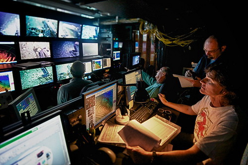
During the NOAA mission “Extreme Corals 2010,” scientists used the Jason II remotely operated vehicle from Woods Hole Oceanographic Institution to survey deep-sea coral sites from the Florida Keys to Jacksonville, Fla., and collect invertebrate and fish samples from depths over two thousand feet beneath the Gulf Stream.
“Deep-sea coral reefs are some of the oldest and most fragile, yet least studied habitats on the planet,” said Andrew David, NOAA research fishery biologist. “Attaining a balance between protection and use of these environments is critical, and this expedition will advance our knowledge of and promote effective management strategies for this important ecosystem.”
Earlier this year, based on recommendations from the South Atlantic Fishery Management Council, NOAA designated the largest marine managed area on the U.S. east coast to protect deep coral ecosystems from Florida to North Carolina. This year’s mission is the first time these reefs will be seen by humans. The protected area prohibits bottom fishing, which could impact fragile deep-sea coral reefs and the marine communities they support.
“Because these deeper regions are at increased risk of exploitation, their ecological role and value need to be better understood,” said expedition chief scientist Dr. Steve Ross of the University of North Carolina. “These ecosystems represent thousands to millions of years of development and once damaged, they may never recover,” said Ross.
During the Extreme Corals 2010 mission, research teams used multibeam sonar to map more than 800 square miles of deep-sea coral habitat inside and outside the protected area.
“High-resolution maps greatly increase our ability to locate deep-sea coral reefs and are an invaluable tool for scientists and the management agencies tasked with protecting these ecosystems,” said expedition co-chief scientist Dr. Sandra Brooke of the Marine Conservation Biology Institute.
Deep-sea coral reefs can reach several hundred feet above the seafloor and are constructed by delicate branching deep-sea corals that provide habitat for an abundant and diverse community of marine life. Some deep-sea corals grow only millimetres per year, and deep-sea coral reefs can take thousands of years to form. The skeletons of deep-sea corals can be analyzed as tree rings on land to look at past environmental conditions, providing a record of thousands of years of ecological changes.
NOAA’s Coral Reef Conservation Program, through its Deep Sea Coral Research and Technology Program, sponsored the expedition, now in year two of a three-year project in the southeast U.S.
Expedition partners include: NOAA, University of North Carolina Wilmington, Marine Conservation Biology Institute, North Carolina Museum of Natural Sciences, Harbor Branch Oceanographic Institution/Florida Atlantic University, University of Louisiana-Lafayette, Texas A&M University, and U.S. Geological Survey.
NOAA’s mission is to understand and predict changes in the Earth's environment, from the depths of the ocean to the edge of space, and to conserve and manage our coastal and marine resources.
- Log in to post comments

")
")


")
")


")